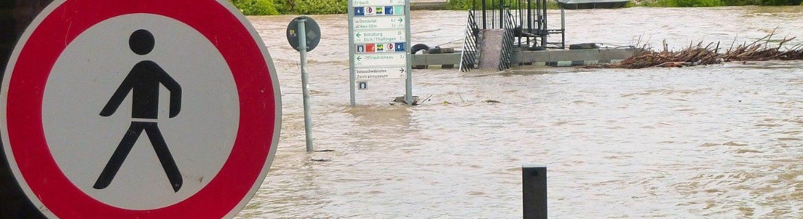
Whether heat waves or heavy rain: Cities with their high population and building densities are particularly hard hit by the impacts of climate change. The research consortium “CoKlimax”, under the management of the City of Konstanz and with participation of the Institute of Engineering Geodesy (IIGS) at the University of Stuttgart, now wants to develop decision-making tools that will help urban planners adapt their concepts to climate impacts, utilizing the datasets from the European Earth observation program “Copernicus”.
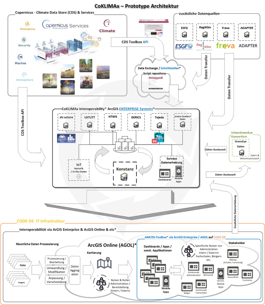
High-quality geographic, climate, and environmental data are of vital importance for reaching the sustainability goals and for the efficient planning and implementation of appropriate climate protection measures. Such data is already available, for example, from the remote-sensing program “Copernicus”. Using its own satellite fleet, the program provides Earth observation data for environmental protection, climate monitoring, natural disaster assessment, and other societal tasks. At the municipal level, however, this data has only been used to a limited extent so far, because there are no practicable tools available with which remote-sensing data and local data can be reasonably combined and processed for urban planning.
The focus is on heat, water, and vegetation
Against this background and within the framework of the CoKLIMAx project, the researchers want to develop easy-access IT tools and efficient work processes for the collection, processing, evaluation, and use of geoinformation by the municipalities. The focus here is on heat, water, and vegetation as the contexts of application. The project partners aim to facilitate data-based decision-making regarding climate resilience issues such as the microclimate, the circulation of cold and fresh air, the designation of green spaces and open spaces, and the management of precipitation and water. The tools will first be developed for the City of Konstanz and, following an evaluation, are to be made available to other municipalities.
Within the framework of the project, the staff of the IIGS at the University of Stuttgart will be concerned with the entire technical implementation. They are developing a tool that specifically prepares geodata available from the Climate Data Store (CDS) of Copernicus as well as data from local in-situ sensors, combining them in the process. In order to make the geoinformation and services available to the individual municipal specialist departments - as well as to citizens - in a way that is simple and easy to follow, a toolbox will be set up whose results are displayed on a dashboard. “In this way, access to the geodata will be created that opens up new possibilities for steering the municipality - like a citizens’ or a mayor’s cockpit,” explains Christoph Sebald, who is one of the Stuttgart scientists involved in the project.
About CoKlimax
The project consortium “CoKlimax” is managed by the City of Konstanz as the consortium leader and is supported by the Institute of Engineering Geodesy (IIGS) at the University of Stuttgart, the University of Technology, Business and Design Konstanz (HTWG), and the Climate Service Center Germany (GERICS) at the Helmholtz Center Hereon. Colleagues from the Munich Technical University (TUM), ESRI Germany, the Tejeda engineering firm, and the engineering company str.ucture are associated partners. The Federal Ministry of Transport and Digital Infrastructure (BMVI) supports CoKlimax within the framework of the “Climate adaptation strategies for municipal uses” with a total of about EUR one million, of which the amount of EUR 255,000 is received by the University of Stuttgart.
Expert Contact:
Volker Schwieger, University of Stuttgart, Institute of Engineering Geodesy, phone: +49 711 685-84040, E-Mail